Watershed Maps is a hands-on activity where students make a 3D map that demonstrates and defines the concepts of watersheds, and point and nonpoint source pollution. Using just a piece of paper, markers, and a touch of water, students will follow along and create their own working model of a watershed.
|
|
|
|
|
|
|
|
|
|
|
|
|
|
|
|
|
|
You don't have permission to access this tab.
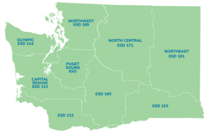 Please select the district(s) your located in. Used this map for reference.