The 3D Augmented Reality (AR) Sandbox is an interactive tool uses a specialized computer software to map contour lines, which then allows users to create topography models with real sand. The AR Sandbox will be utilized during school events, water festivals, and various outreach activities throughout the year to teach earth science concepts and help users understand mapping, topography, watersheds, and more.
|
|
|
|
|
|
|
|
|
|
|
|
|
|
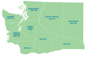
 Please select the district(s) your located in. Used this map for reference.